Contact Us

Use the form on the right to contact us.

You can edit the text in this area, and change where the contact form on the right submits to, by entering edit mode using the modes on the bottom right. 

800 S. Francisco St.
Mission, TX
USA

Our website is all about motorcycles, especially BMW cycles. We cover rides in the Southwest and Mexico, motorcycle modifications and review motorcycle products. 

Big Bend National Pk.jpg

Ride Reviews

West Texas On Fire - Motorcycle Ride in West Texas

Ricardo Perez


`
Wildfire View from Sanderson's Desert Air Motel

I had to run up to Alpine to give a presentation on a new insurance package to our TRLA Alpine Office, but after the first question I had to use my "call a friend life line" to our Benefits Director. After that call I just held the posters and as Julie said, I was in my best Vanna White mode. An exhausting presentation.
Tomas and I had started out early from Mission stopping in San Isidro for breakfast where we were warned not to stop for any suspicious looking police/deputy/DPS vehicles because there's been a rash of robberies by men pretending to be cops. Just like the Zetas in Mexico. Good to know that there's nothing like having a little bit of Mexico in South Texas to make the ride more interesting!
We've been in a drought throughout Texas and the valley had not had significant rainfall since late July 2010 so when we saw the thunderstorm approaching us north of Hebbronville we were glad to see rain clouds. That good feeling didn't last too long as we had to pull over about 20 miles south of Freer, pull out the rain gear and move on. I have a BMW one piece rain suit that I brag about being absolutely water proof and the perfect outfit for any thunderstorm. I was wrong. The rain really started falling and the wind was blowing the rain sideways and soon I began to feel rain coming up my sleeves because I forgot to put on my neat rain gloves, the ones with the little squeegee on the forefinger for wiping the water off my face shield. Those gloves overlap the rain suit sleeve, my summer riding gloves don't do that and with no place to pull off the highway it was too late to change. Then I felt water dripping down my neck onto my shirt and rain coming up my pant legs so by the time we made the Love's Truck Stop in Encinal some 70 miles later, I was soaked. A guy who passed us up on the way to Encinal was also at Love's and came over to tell us that he couldn't believe we were riding in that rain and that he wouldn't do it for any amount of money. It's hard to look like "mancho man" when you're soaking wet so we just smiled and said it cooled us off. I switched shirts, fueled up and rode on. The clouds were gone past Encinal and 30 miles later I was totally dry.
Riding in the rain, if you stay dry, is not bad especially in summer months when it's a nice cooling off break. The only scary part, apart from hitting water puddles and fearing hydroplaning (not a good thing on two wheels) is lightening. Before getting to Freer there were some pretty nasty flashes that were a little too close for comfort. I can feel myself ducking as we cruise by those big radio antennas. I'm thinking that the rubber tires prevent grounding with the pavement so I should be okay, right?
There's not too much change in the landscape from the valley and the rest of South Texas not until we pass Eagle Pass, about 20 miles west on Hwy 277 do things change as we approach Quemado, Texas. Quemado is a small town sitting in what is a beautiful oasis of green pastures and huge pecan groves. There isn't anything like it east or west for hundreds of miles. It's by the Rio Grande River with its pastures and groves irrigated by a series of canals. It's worth the time to get off the highway and take the narrow two lane county road which parallels the river for a few miles.
Another 36 miles to Del Rio, stopped at Rudy's BBQ for a late lunch before continuing on Hwy 90 west to Alpine from Del Rio. We're running late so there's no time to stop at the Pecos River overview of the highest suspended bridge in Texas or at Judge Roy Bean's Museum in Langtry as we kept rolling west.
West Texas Fires - photo by JBalovich
We fueled up in Sanderson, Texas and had been on the road all day with 455 miles behind us and only 84 to go on Hwy 90 before reaching Alpine, Texas. As we rolled into Sanderson the setting sun silhouetted what I thought was a beautiful rain cloud finally making their way into dry, drought stricken West Texas. Between that beautiful cloud and our bikes sat on the middle of our lane two Sheriff Deputy vehicles with their red and blue lights flooding the highway. No doubt some type of license check point or a search for poachers. I was wrong. As I pulled up to them they said the road was closed because there was too much smoke across the highway. That's when I realized my beautiful rain cloud was actually smoke from the burning fires. The deputies said that the wind usually dies down at night so the highway might open by 1am or we could head north to Fort Stockson on Hwy 285 and then south on Hwy 385 to Marathon, a 120 mile detour. The wait would be too long and riding at night is never a safe alternative in deer country so we checked in at Sanderson's Desert Air Motel for the night. The $48 room charge convinced me that stopping overnight was a smart move.
Still burning by Hwy 90 West of Sanderson

West of Sanderson fires rule. With the highway now open I left the motel at 7am leaving Tomas to get some more sleep. Highway 90 west to Marathon was open, but it was still burning just off the highway and with the winds picking up again during the day the highway would close again by that afternoon.

Friday morning and the fires are still burning. This is how much of the area looks like now.

Late Friday morning Tomas joined me in Alpine and we headed south to Study Butte before entering Big Bend National Park. The skies were still hazy as far south as the park. At the Chisos Basin we met a fellow rider on a Ducati riding from Phoenix, Arizona to Houston. He had been riding since Tuesday (four days) and heading east. I mentioned that unlike his ride from Phoenix we were just down the road about 600 miles and then it dawned on me that we were about the same distance from each other. On the way north we were at the speed limit of 75mph when suddenly a very huge buck stood in front of me on the middle of the highway. I slammed on the brakes, but he just looked at me like I was invading his space. He walked off, leaped a fence and disappeared into the woods. To say he jumped the fence would be wrong, implying that effort was involved, and with a graceful walk he glided over the fence as if it were only a foot high.


We left Big Bend by way of the North entrance coming out in Marathon planning to head east to Sanderson for a second night's stay. Unfortunately, Hwy 90 was again closed so we rode back into Marathon to try and find a room for the night. Alpine was booked, and so was Marathon. We had no choice, but to go north about 60 miles on Hwy 285 to Fort Stockton. We landed a room at the Hampton Inn. We rode about 340 miles on Friday before we finally ending up in Fort Stockton.
About 10pm Fire Fighters started coming in for the night. Seems all were young, looking like America's real cowboys, beat and weary from fighting fires. They all carried their packs with everything from sleeping rolls to work boots. By 6am they were eating breakfast and gone by 6:15am. These young men and women had to be worn by the daily grind of coming in late at night and leaving before daylight.
West Texas blazes. Photo by JBalovich
Saturday morning we were off at 8:15am riding to Eagle Pass, Freer, Hebbronville and home. We rode 534 miles on Saturday and 1,335 miles in three days.
It was impressive to see the charred landscapes looking stark and strange like something from another planet. Rain will certainly help put out the fires and restore the landscape to its natural beauty. Until that comes about it's worth your time to see parts of West Texas in this unusual setting.


View Larger Map

The Three Sisters Hill Country Motorcycle Ride

Ricardo Perez

Luckenbach Store Front
For our first real ride in April my wife and I rode along with Albert and Lisa Chapa to the hill country to ride the popular Three Sisters. We left Mission on Thursday about 9:30am and rode on the Expressway 83/281 about 20 miles to Susie's a small restaurant just past the Flying J and before Love's truck stops. It's a tiny restaurant with good breakfast plates.
By the time we rolled out from Susie's it was about 11am, but we were in no hurry since our ride that day was the destination. We stopped twice, at the rest stop in Falfurrias and then at the rest stop past Three Rivers before heading into Pleasanton then west to Jourdanton to gas up. North of Jourdanton we took Hwy 173 to Hondo then Bandera and Medina on old highway 16. Nine miles north of Medina is the Koyote Ranch RV and Resort where we stayed for three nights and four days.
Koyote Ranch is an out-of-way place with a restaurant, store, an outdoor stage with a live band on Saturday nights as well as neat little cabins next to the general RV lots. The particular weekend we were there was also an annual bike rally for gay women and the place was packed so there was good live music and interesting bikes! We stayed in some of the cabins that can sleep up to six or so, but we each had our own cabin with a neat rear patio deck, great for just sitting and drinking some cold beer.
Our first day's ride totaled approximately 330 miles so we had plenty of time to just kickback and enjoy the rest of the afternoon and evening.
One of my favorite bikes at the museum.
Vanderpool, Texas

Friday we rode into Medina for breakfast then get on Hwy 337, the first of the Three Sisters Highways, riding west towards Vanderpool. In Vanderpool we made the ritual stop at the Lone Star Motorcycle Museum. I've been to the museum at least half a dozen times, but it was Albert and Lisa's first visit and I always like to stop there. You've got to support somebody that's crazy enough to put a motorcycle museum in the middle of nowhere! Of course, we  checked out the vintage bikes and enjoy some nice bench time before continuing west on 337.
Next stop was Leakey which has a nice big gas station now on the south side of town as well as a good outdoor BBQ & Beer joint right on the northwest corner of the Hwy 83 and 337 intersection. We fueled up in Leakey then continued west on 337 to Camp Wood for an early lunch. Camp Wood is most famous for Charles Lindbergh. He landed there in 1924, three years before his historic trans-atlantic flight, and crashed into a local store trying to takeoff. He had to spend a week or more there while parts arrived to repair his damaged Jenny.
From Camp Wood we headed north on Hwy 335 for the second leg of the Three Sisters. Being further west and because of the ongoing drought the ride on 335 showed just how dry things are this spring with no rain. Twenty eight miles north Hwy 41 intersects 335 so a quick 10-15 mile ride east on 41 and you're at the Hwy 336 intersection. Headed south on 336 for 27 miles and although you can't see it most of the time, we are riding parallel the Frio River all the way back in Leakey. This time we stop for a cool beer before heading back east on 337 to Medina and then Koyote Ranch. This was Friday and it was a great day of riding and we got to ride the famous Three Sisters, Highways 335, 336, and 337.
Friday afternoon we were joined by my brother, Tomas, and Ed Ramirez and late that same night Marco Gutierrez rode in from Edinburg. Saturday morning the seven of us rode north on old Hwy 16 into Kerrville for breakfast. Old Hwy 16 north of Medina is a very scenic hill ride that has several low water crossings as well as two hairpin turns. It's another must on anybody's riding list. After breakfast Tomas and Marco split off and headed to a BMW rally in Llano while the rest of us rode to Fredericksburg for a couple of hours before heading to Albert, Texas. Albert is much like Luckenbach, but without the people. It's got a dance hall and two huge oak trees which are the hallmark of Albert. It's worth the ride if you like out of the way places without the crowd you find in Luckenbach.  From Albert we headed towards Blanco then Luckenbach. Since it was Saturday afternoon a live band was performing. The music was great, but too many people so we headed back to Kerrville for some BBQ before attending mass at the local Catholic church. We rode into Koyote at dusk and settled in for a quiet night of listening to the live band from our cabin balcony.
Sunday morning and time to head back home. After breakfast in Hondo we made our way back to the valley via Hwy 16 through Tilden, Freer, Hebbronville, La Gloria, McCook and back to Mission. A great four days of riding with good friends, nothing better!
View Larger Map
View Larger Map

Motorcycle Riding to El Salto - Velo de la Novia: Zaragoza, NL, Mexico

Ricardo Perez

Lunch Time
Back when it was safe to travel in Mexico we rode to El Salto known as "Velo de la Novia" (bridal veil) is located in Zaragoza, NL, Mexico. It's off the main roads, but a unique area to visit while touring in Mexico. We made our way into Mexico in Reynosa and stayed on the autopista (expressway toll road) down to the China exit then took the less traveled roads to Montemorelos, Linares, Galenana, Doctor Arroyo, and finally Zaragoza. It was a misty afternoon on our arrival and the cobblestone roads can get slippery, but we managed them well enough to stay a while and enjoy the waterfalls.
Waterfall at El Salto

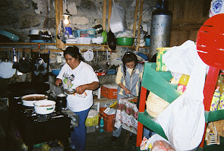
In the Kitchen

 We arrived after lunch, but by mid-afternoon the kitchen opened for business. Pulling fresh trout from holding tanks somewhere above the park area we were treated to feast for just a few dollars. If you're ever in this area be sure and make time to see the waterfalls and be sure and get some great trout for lunch.
DJ & Sonia

DJ, Sonia, Mary & Jaime

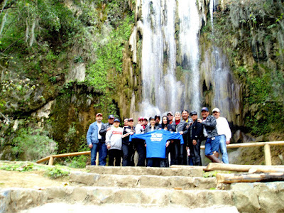
The Gang


View Larger Map

Touring & Culture in South Texas via Motorcycle Riding

Tomas Perez


There are times in my day that are totally wasted by sitting around and thinking of an excuse to go ride. For example, yesterday I had planned to run an errand that took me to the town west of my hometown. Before I had a chance to set out on my errand I got a call from my son asking me if I could go check a problem with the AC unit in one of his businesses that is located to the east of my hometown. I decided I better do my part in conserving energy (gasoline in this case) and take my motorcycle instead of my of my cars. That's all the excuse I needed.

It was the new business opening last week that provided another excuse to take a longer ride to a little known attraction that is located about 80 miles to the north of Mission. I decided to visit the shrine of Don Pedro Jaramillo in the town of Falfurrias, TX. Don Pedro was a curandero or faith healer in south Texas around the turn of the century.


Being the middle of March the day was quite windy but one of the advantages that I have noticed on current touring motorcycles is that they offer such good wind and weather protection while remaining very stable regardless of wind direction. It's not as exciting to discuss as horsepower, top speed, or acceleration but I think these company spend millions of dollars studying the dynamics of cross winds on both the motorcycle and the rider. My current ride continues to amaze me in how well it handles in high cross winds.

I left my house and took the back roads to a connecting point to north bound highway 281. That short ride gave me a chance to get my riding legs ready for the trip before hitting highway speeds. I glanced at the fuel level and wondered if it was enough to do the 80 mile one way ride as it showed a little more than half a tank. I hit the trip computer button to see the remaining range and see that the computer is showing about 180 miles! It must be that high since I am crusing at about 55 mph where mileage is about the highest it can get (excluding rolling down a hill or mountain - been there, done that). The bike always does well over 50 mpg when I don't ride faster than about 70 mph and even at 70 mph I get about 50 mpg assuming no high head wind. Anyway, at 180 miles I'm good to go.

Once I'm on highway 281 riding due north I force myself not to use the cruise control until I am out of the valley and see far less traffic on the road. This is the first bike I've ever had that has a true cruise control. I now wonder how I functioned without one for so many years. About 15 miles north of Edinburg I get lazy and switch the cruise control on at 70 mph - the legal speed limit. The GPS shows 67 mph so I tap the cruise increase button twice and my true speed is now 70 mph. For good measure I tap it 3 more times and I am now cruising at an indicated speed of 78 or a true speed of 75 mph. At this speed my speedometer reads about 3 mph faster than true speed. My mind always factors this in when I set speeds. The time is now nearly 3PM and I want to make sure I get to the shrine before the little local store next to it closes for the day. What I need is an item that is sold in that store.

Don Pedrito Jaramillo died in 1907 but he had many followers and other people that believed in him. He was buried in Falfurrias in a ranch cemetery. Some time after his burial a shrine was built over his grave.


Don Pedro's grave is located in this corner of the shrine.


The second photo (below) shows the many photographs that people have attached to the walls of the shine either requesting help or claiming that they were helped or healed by a prior visit.


After talking to the lady that runs the store for nearly an hour I loaded up the bike so that I can head back into town about 4 miles away. Fuel level was still good but I wanted to top off before heading back home. I top off the tank with an additional 4.96 gallons. That means I had at least 1.6 gallons left in the tank. A funny thing about an RT gas tank is that it is really a 7.1 gallon tank that BMW downgraded to 6.6 gallons by putting a filler tube part of the way into the tank. This forces you not to fill the tank to the very top (unless you stand there and keep nursing a little more gas at a time as you fill above the bottom of the filler tube). Some riders have even been known to remove the tube from their bikes! If those BMW engineers only knew what they are doing to their bike...

I stopped doing that... takes too much time and besides it splashes little drops of gasoline around the top of the tank and that really bothers someone that is OCD about their bikes. You see - being on the road you can't simple wash the area well with car washing soap and water, polish the area again, and finally apply a good 2 or 3 coats of wax. And if you want to do the job right you should remove the tank bag rails. That's not too bad... remove the seats and 4 Torx screws and you're set to really clean that area under the rail. Well... you get my point.

Anyway, in my opinion BMW added this filler tube on the remote chance that you would 1) put the bike on the center stand and fill it to the very top of the gas tank neck on a really cold day and then 2) roll or ride the bike a very short distance and park it on the side stand, and 3) the day heats up a lot and the gasoline expands overfilling the tank getting into charcoal canisters, spilling on the ground, blown into catalytic converters, blab, blab, blab. Disclaimer - I'm just kidding here! No hate mail! Remember - I'm OCD about this thing!

Back to the gas station. I reset my odometers, turn on my GPS (don't know why - I've taken this road about a hundred times), tune in my XM and point the bike due south. Two miles and I'm out of town so it's cruise control time again. Time to sit back, listen to the sounds (review on this soon), and enjoy the ride home. The temperature is dropping under 80 making for a perfect ride home.

Oh... almost forgot. This is what I purchased for my son's new business.


I guess the modern aspect to this is that the candles are in English and Spanish. In my discussions with the lady she told me to wash them just in case someone else had touched them, light them and let them burn, and if they went out or got black that it was a bad sign. I washed them when I got home.

Keep the rubber on the road,
tsp


Big Bend National Park via Motorcycle: Santa Elena Canyon & Castolon on Motorcycle

Ricardo Perez

Santa Elena Canyon

Sotol Vista Overlook
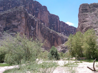
Most visitors to Big Bend National Park seldom take the time to make it all the way to Santa Elena Canyon on the southwest corner of the park. It's one of the most interesting parts of the vast environmental diversity found in the park. If you're coming in from Alpine, Marathon or even from a campsite at the Chisos Basin within the park you'll notice that it can be very hot down by the canyon. My wife and I have camped out at the basin with temperature about 80 degrees and by the time we reach the canyon it was 20 degrees hotter, a 100 degree day. On a motorcycle those 20 degrees are light years apart on the comfort level so be prepared to peel off layers of clothes as you approach the canyon. If you go into the park via Study Butte on the western end of the park the turnoff to Santa Elena Canyon is about 13 miles away. The ride is about 30 miles from the turnoff.  About one third of the way down is the Sotol Vista Overlook.  Don't pass this up, the ride is less than half a mile and worth the stop to take in the view.  Santa Elena Canyon is in view about 12 miles away as the crow flies, but another 20 miles or so on the road. Friends with a BMW GS or other worthy off road bike can circumvent this route by taking the unpaved "Old Maverick Road" that hugs the western boundary of Big Bend National Park and cuts the travel distance in half or more. Old Maverick Road is a 13 mile ride to the canyon.
Eight miles before reaching the canyon is Castolon Visitor Center. It's a must stop if its 100 degree weather. There's water, soft drinks, snacks and usually a great person behind the counter ready to share some time with visitors. Over the years we've met several workers stationed at Castolon and you really have to admire their dedication to their job and the National Park Service. Talk about being stationed away from civilization! This is it.
Majestic View From Sotol Overlook

Evaporating "low water crossing" close to the canyon

Castolon Visitor Center Patio

Creek at Santa Elena Canyon


Santa Elena Canyon and Road's End
Another eight miles down the road is Santa Elena Canyon which is not always accessible. If it has rained then, most likely, the road is impassable to traffic at anyone of the numerous low water crossing those last few miles. We once went about three straight visits to Castolon only to be turned around due to high water. There is a turn around at the end of the road and about 75 yards from there is a sandy walk to Terlingua Creek that merges into the Rio Grande River. If it's not raining or rained the night before you can walk across the creek and meet up with a steep path that runs almost a mile along the canyon wall above the river. It's a very nice hike if you can cross the creek.
If you are already in the park then plan to spend at least a half day to enjoy the canyon. Remember it takes about an hour to get there, then a rest stop at Castolon, and at least an hour or two at the canyon makes for a long day trip. There is also Mule Ears Viewpoint which you can see on the way back. An even longer day is if you're in Alpine, 82 miles from Study Butte or Terlingua so plan accordingly. It's just as far from Marathon if you enter from the north entrance.
Big Bend National Park gets over 300,000 visitors a year, but I know that's not in July. We've been there during the summer months and its fairly void of other humans so you have the whole place to yourselves.  Did I mention it gets hot? Last summer my wife's shoe literally melted apart so plan ahead and take sun screen, water, more water, and snacks.  April and May are good months to visit since its still a little cooler.
There's also rafting trips you can take down the river from Lajitas. It used to be a really neat old town, but somebody bought the whole town and gave a Gucci type remake. It has fancy stores, a golf course, and even an airport landing strip for private jets. We've ridden through it many times and we even stopped once. 
Residence at Castolon
Sotol Vista Overlook Parking - Not Too Crowded in July!


View Larger Map
Irma at Sotol Vista Overlook


July is hot enough to melt your shoes off!
Castolon Visitor Center and Canyon visible 8 miles away

Motorcycle Riding Hwy P100 South Padre Island

Ricardo Perez

SPI Hwy P100
One of our favorite "short rides" from the upper Rio Grande Valley in Mission is to head over to South Padre Island via Military Hwy so named for its original purpose of connecting the valley's two forts, Fort Brown in Brownsville and Fort Ringgold in Rio Grande City.
Fort Ringgold not named after the famous Beatle, Ringo Starr was settled in 1848 served until its closing in 1944. Likewise, Fort Brown, not named after famous singer James Brown was settled in 1845 and was decommissioned in 1946.  Connecting the two forts is Military Highway which was originally laid out for General Zachary Taylor in order to get supplies from Fort Brown to Fort Ringgold. It wasn't until the 1960s when the entire Military Road Highway was paved.
View from Wanna Wanna's Bar
We're in Mission so when we hookup with Military Hwy we're at the halfway point between Brownsville and Rio Grande City. It's a much longer ride especially in time taking Military verses staying on Expressway Hwy 83, but the ride is much more scenic especially at this time of year when there are fields upon fields of winter vegetables growing and being harvested. Unlike the hectic and crowded expressway, the Military Hwy route is a much better ride. We turn off Military heading north and coming out at the intersection of Expressway 83 and Hwy 100 then its about thirty miles to South Padre Island.
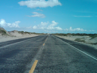
Once at SPI there are quite a few things you can do including riding up the highway to the pavement's end on the north end of SPI. Usually its a nice quite place to go except for an occasional RV along the side of the road parked for the night there isn't much to distract from the great view of the dunes and seashore. If you like to sit back, have a nice beer or soda, and listen to some live outdoor music then the place to be at is WannaWanna's. It's a small hotel http://www.wannawanna.com with an outdoor deck and thatched roof bar overlooking the seashore.  It's a great place to spend some time before heading back home.
Ed rolling past huge dunes on P100
End of SPI Hwy P100

View Larger Map

Mt. Evans via Motorcycle: Highest Paved Road in North America

Ricardo Perez


Echo Lake
I'll admit I'm afraid of heights and even though riding to the top of Mt. Evans Scenic Byway was a real rush it's not something I'd like to do again! In a four wheel drive vehicle it would be great, but it will still have you holding your breath on some of those hairpin turns. It's something I'm glad I've accomplished, but it was never on my bucket list of must things to do. Mt. Evans lies west of Denver and its narrow road, without guard rails and with dramatic drop offs and snow covered sides lays claim to being the highest paved road in the North America.
Our ride started in the Rio Grande Valley of South Texas in June at 5:30 am on a typical day in South Texas, a perfect morning soon to get hot. There were five of us riding, Marco Gutierrez a local physician who lives in Edinburg riding a BMW GS, his brother David who flew in from Florida and had his Yamaha at Marco's house ready to ride, Ed Ramirez a computer programmer at the University of Texas at Pan American from Alamo on his 2010 Harley Davidson, my brother Tomas Perez on a Honda ST 1300 and myself riding my 2008 HD Ultra Classic. We decided to avoid the major highways on our trip to Colorado by riding along the less frequently traveled roads or what we call the back way to West Texas. It's a lot quicker ride if you stay on the interstates, Highway 281/37 to San Antonio then I10 West with speed limits at 80 west of Kerrville. Our more pedestrian route first took us to Hebbronville on Hwy 1017 via McCook and San Isidro. From Hebbronville we took Hwy 16 North to Freer before turning northwest on Hwy 44 to Encinal then north on Hwy 83 to Carrizzo Springs and on to Del Rio, 300 plus miles from Mission. It was lunch time and we stopped to eat at Rudy's BBQ.
West of Del Rio is the Pecos River and Langtry, home to Judge Roy Bean, Law West of the Pecos fame. The bridge crossing the Pecos is the highest suspended bridge in Texas and it crosses the Pecos right before it merges with the Rio Grande River. We stopped at the Overview park to check out the view of the Pecos River, the bridge and off at a distance to the South the Rio Grande River.
Pecos River
It was over 100 degrees in Langtry, so we stopped at the very nicely built Texas Department of Transportation (TxDot) Travel Information Center. It's home to the historic saloon of Judge Roy Bean and just about every publication at the center is free including complimentary copies of Ride Texas Magazine. Langtry is like an oasis in the desert so it's worth the stop.
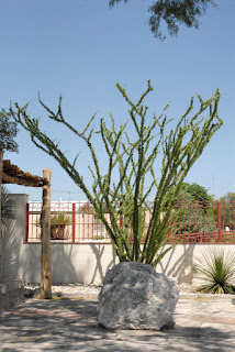
TxDot Information Center
On the road again, its now hot enough to make you think about how great tires are that they can roll mile after mile on pavement that's got to be at least 115 degrees without melting. You don't think about that in a car, but it sure crosses your mind on a motorcycle. Being partial to a tire manufacturer dedicated to motorcycle tires, I run with Metzeler and like their grip in the rain. We continued west along Hwy 90 to Sanderson, a town with two noteworthy gas stations. There's a popular big gas stop at the western end of town and on the east end of town a small gas station with a shaded picnic table that makes for a good soda break. I'm not sure why Sanderson is out there, maybe because of the intersection on Highway 285? It's this highway which we took as we headed 65 miles northwest to Fort Stockton. Fort Stockton is on I10W so it gets traffic running between El Paso and San Antonio especially truck traffic. We crossed Fort Stockton still headed northwest toward Pecos, another 55 mile jog. Pecos is usually very hot and dry, but we were lucky to hit a thunderstorm as we rode into town. The welcome rain cools us off for the rest of the day. Pecos is not suited to handle much rain and the streets were quick to flood. We weren't far from the Land of Enchantment, New Mexico so we pushed on. It was getting late in the afternoon so temperatures started to cool off as we entered New Mexico. There's a dramatic drop in speed limits going from Texas to New Mexico from 75mph to about 60mph. That's pretty unbearable on roads with little or no traffic so we ride at a conservative 73mph as the GPS reads. We rode past Carlsbad as the sun set and stopped for the first night close to Lakewood at a local KOA Campground. It was a good first day's ride, approximately 742 miles, and ready for dinner.
KOA Camp North of Carlsbad, NM

Day two was a much cooler day. We took some back roads toward Roswell where we stopped for breakfast at Denny's. Western New Mexico is fairly flat and the winds can really blow. We rode through some strong cross winds and luckily squeaked through threatening thunderstorm clouds that made the storms back in Pecos look like a spring shower. Traveling northwest we stopped for a couple of hours in downtown Santa Fe. We had a light lunch at the French Pastry Shop & Creperie by the plaza. They have great pastries and good coffee, a must stop if you're in the area.
Downtown Santa Fe near French Pastry Shop

We continued our ride through Santa Fe and headed north toward Pagosa Springs, CO and the San Juan National Forest. Cross into Colorado and the landscape turns emerald green a sharp contrast from the desert sands of West Texas and New Mexico. From Pagosa Springs we headed west to Durango and ending our second riding day. We had crossed the entire state of New Mexico, an easy 500 mile day compared to our first day's ride.
Close to Pagosa Springs, Colorado

Durango, Colorado is home to the Narrow Gauge Railroad that runs between that town and Silverton. It's a popular ride and one I had taken many years ago when my kids were younger. The scenic ride meanders through the mountain passes to Silverton.
Silverton, CO
Silverton, the only scheduled stop, offers enough time for shopping and lunch before heading back to Durango.
We stayed at the Holiday Inn Express and got a late start because I wanted to wait for the local Harley Davidson shop to open so I could buy a heated vest. Seems I packed long sleeve shirts, but not nearly enough warm clothes for the upcoming days. We would experience temperatures as low as 36 degrees on our trip, a dramatic difference from the weather in Langtry! Finally, late that morning we rode west to Mesa Verde National Park. The cliff dwellings of the Pueblo people date back to 600AD and it's good ride. The terrain flatten out as you go west and things warm up a bit.
Mesa Verde National Park
We backtracked to Durango and headed north to Silverton then Ouray.
Ouray is known to some winter tourists that visit us in South Texas as the little Switzerland of the USA. Having never been in Switzerland I have no clue as to the truth of that statement. Ouray is nestled between some fairly big mountains leaving you the sensation of being in a bowl.
We continued north to Montrose, but decided to double-back south to find Ridgway State Park near Ridgway where we wanted to camp for the night.
Ouray the little Swiss Town
We pitched our tents, made a fire, and chatted into the night before getting into our sleeping bags. It was 46 degrees that night so our sleeping bags were perfect for a cool night. I've always camped with our Marmot sleeping bags rated at 30 degrees and our Comet two person tent from Sierra Designs. The Comet has extra strength poles for those windy nights. Both of these come from REI online orders.
Ridgway State Park is rated as one of the top ten state parks in the United States. If you walk to the top of a small hill there's a beautiful view of an adjoining lake. We had two campsites, but decided to group our three tents on one site and got in trouble for that. We used one site to park the bikes and another to camp, but park rules limit the number of tents to two per site. Who knew?
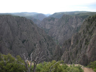
Black Canyon
Marco Gutierrez at Black Canyon
The Park Rangers at Ridway State Park, yes, the same ones that got after us for too many tents on one site were very good in offering us travel recommendations. They recommended we stop at the Black Canyon mentioning that most people don't even realize its there and its often overlooked even though its a great place to visit. We took their advice and headed in that direction. We had an early brunch in Montrose before heading to the Black Canyon of the Gunnison National Park then back on the road headed east toward Gunnison.
Riding into those mountains as we head to Aspen
We rode Hwy 50 east to Poncha Springs then north on 285 to Buena Vista. North of Buena Vista we caught Hwy 82 and headed northwest to Aspen. Highway 82 is a narrow two lane road that eventually makes its way to Aspen. The weather was overcast and threading to rain, but we made it safely to Aspen. After walking some of the downtown streets in Aspen we decided that it's not for us so we ride on.
Next came Carbondale then Glenwood Springs before getting on I70E and headed to Vail. We stopped for the night at one of the many hotels on I70.
The next morning we continued on I70E headed for the base city of Mount Evans, Idaho Springs which is about 45 minutes west of Denver. Idaho Springs was a welcome site, unlike Aspen or Vail, this town had regular stores and restaurants and just regular working class people. We had been on I70 with typical traffic congestion, but still a beautiful ride as expressways go. After a short break in Idaho Springs we started on Hwy 103 to Echo Lake. Echo Lake has a nice gift shop and restaurant and I don't know if its best to stop there on the way up or on the way down, but I would recommend making that stop on the way down. Weather changes can be sudden and dramatic especially in the late afternoons so it's best to get the ride out of the way before it gets too late. On the way down the Echo Lake stop seems like you're safe again, so stop and get those bumper stickers that say you made it to the top of Mt. Evans. On the way up those decals seem expense, but on the way down they seem like a real bargain.
We started our climb about noon with clear skies. It had been in the 70s down at Idaho Springs, but it was now getting cooler. Just beyond the Echo Lake stop is the official park entrance. An entry fee of about $10 is required. The park road is very different than the highway leading up to Echo Lake. It's much more narrow and the tall forest trees are much closer to the road than down below. The road has a steady climb, the terrain slowly giving way to less trees and suddenly you are above the tree line. Being scared of heights made me tighten the grip on my handlebars, focus on the road and not on the sheer drop-off just a few feet away, and a fixation on my Garmin GPS's altitude gauge. I knew that the switch-backs would end at 14,130 feet so I kept glancing at the GPS wondering if it was really right. The switch-backs literally make 180 degree turns. Keeping the bike upright as you navigate each turn was a challenge. The altitude displaying on my GPS was moving fast, but to me it seemed too slow for me. After every turn around the bend there was more road in front of us, always leading up. Eventually we could see the lookout building and knew we were making it all the way to the top. The temperature was now between 36 and 39 degrees. It was difficult to breath and my heart was really pumping. I think its natural to breath more rapidly to get more oxygen in your lungs. I was wrong and realized that when I read the informational sign telling you to stay calm.
View from top of the highest paved road in North America!
Knowing what lay before us, the ride back down the mountain was very welcome. We could relax and enjoy the view knowing that every turn got us back closer to planet earth.
Once we were back at Idaho Springs we made our way West on I70 and turned north on Highway 40 heading to Grandby. We took the Trail Ridge Road 34 across the Rocky Mountain National Park to Estes Park. The Trail Ridge Road was another high altitude adventure as we crossed the Continental Divide again on our crisscrossing ride in Colorado. Of course, this road was tame compared to the Mt. Evans adventure and the inclines on the cobblestone roads of Real de Catorce in Mexico. Rocky Mountain National Park gets over three million visitors a year and I can understand why as you travel the Ridge Road you will see wildlife like huge elk, green meadows in panoramic views below your road elevation, and snow in the summer. Estes Park is another great park that serves as the East entrance to the national park. It makes for a great camp base before heading into the national park.
We spent our last night in Colorado on the outskirts of Boulder and so ended our rocky mountain ride. We headed out of Colorado via Hwy I70E across the eastern part of Colorado. As we headed east we made Salina in Kansas then south to Wichita and pressed on to Oklahoma City. It was a long day's ride logging over 700 miles. The next day we duplicated our miles by doing another 700 plus mile ride home from Oklahoma City to Mission, Texas. By the time we hit the Texas state line we were back in hot weather and our heavy jackets and electric vests were somewhere deep in our saddle bags by then.
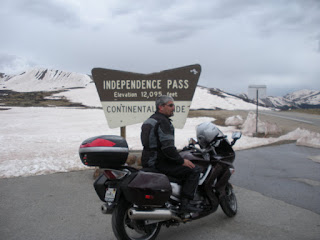
David Gutierrez at Independence Pass - 12,095 Feet

Road leading to summit
We rode over 3,200 miles on our trip and crossed West Texas, New Mexico, Colorado, Kansas, Oklahoma and Texas again, but north to south. We averaged about 500 miles a day at speeds between 80 and 5mph. We weathered temperature changes from 100 degrees to close to freezing, crossed the Continental Divide, camped out, visited several National Parks and got to see the great outdoors.
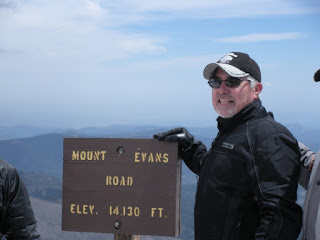
Yep, we're at 14,130 feet!

Tomas, Ed, David, & Marco


Marco Gutierrez, David Gutierrez, Tomas Perez, Ricardo Perez, Ed Ramirez
Summit 14,130'


View Mt. Evans Colorado in a larger map

The Gage Hotel in Marathon & Riding Big Bend Via Motorcycle

Ricardo Perez

Our room at the Gage.
My 2005 BMW LT
Marathon is a small community north of Big Bend National Park, divided by the railroad, trains run just about on an hourly schedule, round the clock. If trains bother you keep riding another 32 miles west to Alpine. Aside from the Austin influence that's taking over some of the real estate and raising prices it is still a great place to visit before heading into Big Bend National Park.  This is especially true if it's late in the afternoon since chances are you will not get a good campsite at the Chisos Basin (that's the place to camp) so I'd recommend staying at the historic Gage Hotel in Marathon, Texas for at least one night. All campsites at Big Bend except for those at the Chisos basin are probably too hot if its after May so check-in at the Gage and get an early start to the basin. Marathon is about 45 miles north of the park entrance and another 20 plus to the park headquarters and finally another 10 to the basin.
The Gage Hotel, built in 1928, has two sections, one being the old historic section and the newer ground level rooms near the pool and an outdoor panel. If you're a history buff stay at the main building, if you want to kick back in the patio and drink some refreshments then go for the newer section.
The Gage also has a nice bar and a good restaurant, but it's pricy and something we usually avoid.
Once in Marathon there are few good places to eat and just to walk around and see. There's an old cemetery across the tracks and just a few miles away are the remains of Fort Pena Colorado which protected settlers from Indians. It was settled in 1879 and closed in 1893.
Downtown Marathon at sunset
rap & irma

An alternative to the Gage is the Marathon Motel & RV Park just west of the Gage. It not as fancy, but it has a great outdoor patio and fire place.  You're free to start up a fire in the fire place and settle back into a lawn chair.

There is a great view of the Glass mountains to the north and east as well as the Santiago mountains to the south and southwest. It has small cabins which are not as nice as the rooms at the Gage. Of course, this is the place to stay if you're pulling an RV.  They will also let you setup a tent if you want to camp out on their grounds. Both locations are great and it's best to call ahead for reservations.
Marathon RV & Motel Patio Area


View Marathon, Texas in a larger map
Laguna Atascosa National Wildlife Refuge on Motorcycle

Ricardo Perez


Laguna looking north up the bay!
Last weekend (March 2011) we took a short ride, 186 miles total, to and from Laguna Atascosa National Wildlife Refuge. It's fairly well hidden and accessible only on a very poorly maintained road especially the last seven miles or so. Parts of the road seem to have washed away and you've got to slow down to about 15mph.  Once in the park there's a 14 mile or so loop around the entire refuge.  The Spanish explorer Alonzo Alvarez de Pineda hit this area around 1519 and it looks probably much like it did then, but look across the bay and it's 2011 with South Padre Island on the horizon's view.  The refuge is mostly dense brush which serves as habitat to a large number of wildlife.  Road signs warn of crossing wildlife, but none in sight on a late afternoon except for an exceptional view of birds both on and off shore. If you don't like big crowds this a perfect place to visit.  Here's the LANWR website:  http://southwest.fws.gov/refuges/texas/STRC/laguna/Index_Laguna.html

Laguna tower and bikes!
SPI in the distance directly across the bay.
Sunset on the West side of Refuge.
From the scenic overview tower South Padre Island is visible across the bay. As a matter of fact you can see Port Isabel, the causeway, and SPI. It's a spectacular view and judging from the little traffic it's a view few people get to see. Ed Ramirez, Tomas Perez and I rode together and stayed through sunset before heading back home.

Real de Catorce Mexico Motorcycle Trip - Not For The Faint of Heart

Ricardo Perez

Los Tejanos Bike Ride
Real de Catorce


Steep Cobblestone Roads of Real


Fred Arellano of the Rio Grande Valley who is very familiar with travel into Mexico organized the Los Tejanos Bike Group for a friendly ride into Mexico last week.  As team leader Fred did an outstanding job of preparing us for the trip by arranging everything ahead of schedule including a group insurance discount rate for our motorcycles.  Everyone had the responsibility of getting their proper visas and vehicle permits.  Getting our paperwork in order required spending anywhere from an hour to several hours at one of the border towns.  Most of us went on a weekend to Nuevo Progresso, south of Weslaco, since the lines are short and people are friendlier in a small town.  Helping organize the event were Ruben Villarreal and Jaime Villarreal.  They even had shirts for all of us to use; blue shirts on the first day and maroon on the last day.  The shirts certainly helped clear the way for us as we were never stopped for any inspections throughout the entire trip.

The trip started early March 10th at the rally point of Fernando’s Restaurant in Pharr, Texas.  Our group was made up of 16; seven couples were riding two-up and two solo riders. Most of the riders were from the Mission, McAllen, Pharr area, but one couple joined us from Corpus Christi, Texas.  We crossed at the Pharr International Bridge (next to McAllen in the Lower Rio Grande Valley) into Reynosa and took the Autopista (Mexican Toll Road) to Gen. Teran.  Leaving the autopista going on the public (toll free) road, we traveled through China, Montemorelos, Linares and Hidalgo all of which are north and then southeast of Monterrey. Our first destination was El Choritto, a small village south of Linares and close to Cd. Victoria.  Its fame comes from a small waterfall (La Virgen del Chorrito) for which the village gets its namesake.

El Chorrito Waterfall
El Chorrito waterfall is beautiful and so is its majestic mountain view overlooking the lake it fills.  We stopped at El Chorrito for a late lunch, enjoyed some of the local attractions such as the church which is part cave and part structure.  After lunch, we made our way back towards Linares and then headed west toward Iturbide and on to Galeana which is high in the Sierra.  It’s only about 75 kilometers from Linares, but it is all twists and climbs.  It’s a fun road to drive and as challenging as anything you can find in Texas.  Thirteen hours after we left Pharr we arrived in Galeana.  It was already nightfall and we were all glad to get that first day out of the way.  We found a local restaurant for dinner and then just milled around the plaza.  Some of the group found a trio and sang their way into the night.  What a great day!


We awoke the next morning to see that we were surrounded by mountains in the beautiful little city of Galeana.  We got on the road by 10am, leaving Galeana and headed south down Highway 61 to our next destination, Zaragoza where on the outskirts of town is the famous "El Velo de la Novia" (veil of the bride) waterfall. The road to the waterfall is also a climb and twisty, but well worth the trip.  Once there we relaxed and eventually got to eat some great tank farm trout.  There were some ladies who run a small convenience store and kitchen who prepared eight broiled and eight deep fried trout for us.  Best tasting trout you’ll find anywhere.  We had too much to eat and got a late departure to our next destination.


Church in Galena, Mexico

Real de Catorce was our destination, but it was quite a ways away.  We would have to go to Dr. Arroyo and Matehuala before heading to Catorce. As it was, we ended up in Matehuala at nightfall with another 75 kilometers or so to go.  Real de Catorce is now a famous little village, high up in the desert at an elevation of 9,000 feet, most famous for the filming of "The Mexican" with Julia Roberts and Brad Pit. It's no place for our big road bikes though since the last 21 kilometers (13 miles) are an old cobblestone road which works wonders on the bike and body.
The last 1.2 mile entrance into the village is an amazing one lane tunnel which goes through a mountain to the village. The cobblestone road into Catorce seemed like a boulevard compared to the very rough route to our hotel once in the village.  We rode in so late that we didn't know that we were suppose to make sure we had a green light before entering the one-lane tunnel. Luckily for us it was late enough that there was no out bound traffic. Once inside Real we realized that the street elevations were no exactly TxDot Highway standards. Some inclines were insane for anyone to handle on a bike. We were so tired that it didn't really bother us, we just wanted to settle in for the night. Our ride required two hairpin turns onto very narrow cobblestone streets with a very, very steep elevations. When we looked at those turns and climb the next day in daylight, all of us wondered how we made it, so in a way, it was a good thing it was dark and we didn't know what we were doing! Parking our bikes was another experience since it was practically impossible to find any flat spot along the road. We parked bike on precarious inclines, left them in low gear, and jammed rocks behind the wheels to keep them from sliding backwards.

Catorce is a very neat little village, with plenty to do and see.  After we settled in we had a wonderful dinner at one of the many hotels and we were welcomed by the BMW Club of Mexico City who were holding an annual rally in Catorce.  We met two riders from Texas (San Antonio and Dallas) who rode up to join the Mexico City Club. After dinner we spent hours in the hotel lobby introducing ourselves to a bottle of “El Cabrito Reposado” tequila and talking about our trip.

Real's Cobblestone Roads

BMW Riders From Mexico City
Our hotel was high up in the village (even much higher than the BMW club members who were all on motocross bikes) so we decided that in order not to endanger anyone, the women would take a leisurely ride on horseback through the village and down to the tunnel entrance.  As it turned out, that was a smart move because it was a job getting our bikes down to that level.
Early Saturday morning a group of five (three bikes) had to leave to meet prior commitments back home.  That left eleven of us at Catorce for a later departure.
Long Road To Real

Steep Roads in Real


Pine Trees - Must be going Up!


One-Way Tunnel

Safe way down from Hotel!

In the Tunnel


Safely Out!


It looks a lot smoother than it really is.

A Level Street!


Fret and his bike

Cool Morning


Notice the rocks we used to keep the bikes from sliding down the road!

Sonia & DJ


Hotel Bar with Posters from the filming of "the Mexican" with Brad Pitt and Julia Roberts


Local native, the one on the right.


The girls took the safe way down to the tunnel, on horseback!


Leaving Real de Catorce


We left Catorce about noon now with Jaime Villarreal in charge of the group.  Once we made it to the highway we all felt like we were riding on glass, so smooth and peaceful compared to the cobblestone road.  We decided to make a hard push to the outskirts of Monterrey.  We passed Allende and stayed in motel in Santiago.  We all had a good dinner and rose early at 7:30am to prepare for the ride home.  We traveled a few miles more towards Monterrey and stopped at Los Cavazos which can best be described as a Taco Row of eating establishments.  We found one which had breakfast plates and then took a side road to Cadereyta.  From Cadereyta we were back on the autopista toward Reynosa and home to Pharr.  We made it back to the US about 4pm on Sunday afternoon.

Los Cavazos 

I think most of us agree that this was the trip of a lifetime.  We certainly challenged ourselves and our bikes in more than a few situations so it made for memorable story telling.  Probably the most consistent obstacle we faced at every city, community, and village are those infamous topes (speed bumps) which are used to regulate speed as you enter and travel within town.  They certainly have eaten more than one rear axle from someone going a bit too fast.  The bikes generally did fine, but we sure got more than our share of scrapes on those topes.  We drove four days, stayed three nights, and logged 1,027 miles on the trip.  It’s not too many miles until you consider that many of them had to be taken between 20 and 30 miles per hour.  A short 225 mile ride turned out to be a thirteen hour day.  We drove each day into the night and dedicated most of the trip to riding instead of sightseeing.

Of course, the greatest result of our trip was the bonding of friendships made on the trip.  Some of us knew very few of the riders when we started out, but by Sunday we were fast friends who had shared a rare and exciting experience.  Those are the friendships of a lifetime.

I don’t know that any of us would do it again!  Of course, we’re already planning our next trip into beautiful Mexico.  It’s amazing that just a couple of hours south of us we have hills, mountains, and a friendly nation ready to welcome us.  You can’t beat that!  Mexico is a beautiful country which offers just about any challenge you’re ready for.


Sunset headed toward Real

View Real de Catorce Mexico in a larger map